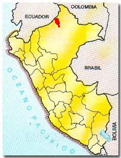
Pucacuro Reserved Zone is Established
Ministerial Resolution No. 0411-2005-AG on April 19, 2005, established the Pucacuro Reserved Zone. Encompassing 637,919 hectares, this area is located in the Tigre District, within the Province and Department of Loreto, and is now part of the SINANPE.
The watershed of the Pucacuro River has been identified as one of the most important areas for ecosystem and biodiversity conservation because it contains a representative sample of tropical humid forest with exceptional richness of species, many of which are endemic, and/or threatened or endangered.
The recent pressures from overpopulation and exploitation of wood, oil, and gold in this area determined the urgency to protect the zone. Studies conducted by both public and private institutions realized the need to categorize the Pucaruro area as a reserved zone. The purpose of this classification is to ensure biological diversity conservation and sustainable and integrated management of the area\’s renewable natural resources, as well as to protect its unique ecological, floristic, faunal, aesthetic, touristic, cultural, and anthropological values, which are characteristic of the tropical humid forests of the Napo ecoregion.
In addition to the information currently available, it is necessary to conduct larger studies and consultation processes in order to define the area\’s limits and definite protection status, taking into account the most appropriate management category. There exists a need to form a commission in charge of the studies and consultations, according to the Law of Natural Protected Areas of the country.
The Cotahuasi Canyon is declared a Landscape Reserve
Through a Supreme Decree on May 18, 2005, the Ministry Council recognized the Cotahuasi sub-watershed as a protected area under the Landscape Reserve category. This category emphasizes a harmonic relationship between man and nature. The proposal was elaborated by the AEDES team, which stands for Asociación Especializada para el Desarrollo Sostenible (Specialized Association for Sustainable Development), and is a non-governmental organization (NGO) whose actions focus on promoting protection and expansion of the civil and political rights of the population, development of self-help and business endeavors, and democratization of local governments in order to strengthen their capacity to implement development within the natural protected areas\’ framework.
Both the organized population and the local authorities of the La Union province have been congratulated for the approval of the Supreme Decree that distinguishes the protected area as the Cotahuasi Sub-Watershed Landscape Reserve. With support and advice from AEDES, they contributed to this achievement from different places in the Arequipa Region, Lima, and other countries.
The residents, local authorities and AEDES team, along with staff from the government agency in charge of natural resources (INRENA) and regional governments of Arequipa, are already working to make this new reserve not only the protected area representative of the high Andean mountains, but also one of the most representative areas worldwide within the IUCN category V (http://www.aedes.com.pe/index.shtml).
The Peruvian government declared this canyon as a reserve, which, with a maximum depth of 11,600 feet, is considered the deepest in the world. The Cotahuasi Sub-Watershed Landscape Reserve is located in the Union Province, in the southern Department of Arequipa, and its biodiversity is globally important.
Like a powerful water snake, the canyon extends from the foothills of the Solimana snow-capped mountain to the confluence of the Ocoña River, with depths higher than 11,500 feet in the Ninacocha sector, near the town of Quechualla.
Aside from its function as a destination for sports- and adventure-tourism aficionados, Cotahuasi has lakes, thermal and medicinal waters, waterfalls, and a great variety of flora and fauna. The area adjacent to the canyon was declared as a Touristic Reserved Zone in 1988, and contains temples, tombs and extensive cultivation areas on the hillsides dating from pre-Hispanic times, demonstrating the work and ingenuity of the native inhabitants in trying to maximize the amount of crop land (http://www.aedes.com.pe/index.shtml).
Antonio Chávez, counselor of the Arequipa Regional Government for the Union Province, stated that the designation as a Landscape Reserve is a triumph obtained by the inhabitants of his province and reminded everyone that on March 3, 1988, Cotahuasi was recognized as a Touristic Reserve. From that starting point, many steps had to be taken until INRENA eventually accepted the petition for a landscape reserve. INRENA in turn approved the motion and then the Ministry of Agriculture gave the green light to the technical report. Finally, the petition was approved by the Council of Ministers. \”That means an array of development possibilities for La Unión,\” Chavez said. He indicated that now a commission or management committee needs to be formed to implement the approved law. \”The first action taken by this committee must be to elaborate a master plan in order to preserve the area [and keep it] free from pollution.\”
The master plan should take into account zoning that is both economic and ecologic for the whole area. Also, mining, agricultural, crafting and fishing zones should be determined so they can receive the appropriate priority. Furthermore, it is necessary to conduct studies in addition to the technical report already prepared on the flora and fauna of Cotahuasi. At the same time, it is important to analyze the potential of the reserve so that the population, who should be trained, can continue to utilize all of the resources in a sustainable way. The problems that can occur as a consequence of environmental degradation and pollution must also be considered.
ParksWatch-Peru: June 2005